31 Oct 2015

Walk 056 - Brookwood Estate


Date: 31st October 2015
Distance: 4.22 kms
Locality: Hilbert

Streets walked:
  • Caduceus Way
  • Vermilion Boulevard
  • Allwood Avenue
  • Paavo View
  • Sharach Retreat
  • Hilarion Elbow
  • Skiptar Grove
  • Levity Cove
  • Rowley Road
  • Letterkenny Way
  • Ardara Lane
  • Bundoran Approach
  • Portnoo Lane
Running street count: 692
Running distance count: 240.37 kms


Brookwood Estate sits literally right on the border between the City of Armadale and the Shire of Serpentine-Jarrahdale, as they share Rowley Road between them. Hidden on these outskirts, I've only ever seen the entrance while driving past, on my way to the rubbish tip, only a few kilometres away. The proximity of a waste refuse facility is no barrier to loving this estate. It's everything that other recent Armadale estates claim to be (new-ish, great water feature to walk around and enjoy, underground power) but it has kept all the established trees and the blocks are massive (by comparison). There is SPACE TO LIVE IN. Space to have a big bloody shed. Space to grow food if you want to, or for the kids to run around (which I witnessed first hand, many of 'em in Halloween costumes). It is idyllic.

This is a beautiful neighbourhood and reminds me of the streets between Champion Lakes and Albany Highway in Kelmscott. City farming. It likely costs a fortune to get a spot in the prime areas, maybe $700,000 at a guess ...

Mind you, there are some recent add-ons that fall in line with with other new areas like Sienna Wood, Springtime etc - tiny blocks, back lanes (no front street access), tree-less, affordable homes giving people options and ensuring it's not all high-income folks living near the tip :)

Another thing that brought a smile to my face was seeing Hilarion Elbow. The Hilarions were a performing group around Armadale (mainly Roleystone so the story goes) that played local events way back in the 1940s. Glad a street has been named after them.

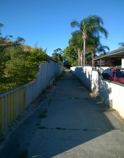
Anyway, have a bunch of pics!


Front yard decorative vehicle #1

Front yard decorative vehicle #2

A remaining old cottage on Rowley Road!

The cheaper side of the neighbourhood.


30 Oct 2015

Walk 055 - Ralphs Street

Date: 27th October 2015
Distance: 3.70 kms
Locality: Seville Grove

Streets walked:
  • Kerrison Parade
  • Fulmar Way
  • Ralphs Street
  • Cable Close
  • Ardross Street
  • Morolo Street
  • Symes Close
  • Pheasant Close
  • Brolga Grove
  • Kookuburra Street
  • Leven Place
  • Waterway Cove

Running street count: 679
Running distance count: 236.15 kms


Fulmar Way.

Walk 054 - Robin Hood

Date: 26th October 2015
Distance: 3.22 kms
Locality: Armadale

Streets walked:
  • Sherwood Court
  • Fifth Road
  • Robin Hood Avenue
  • Locksley Avenue
  • Sheriff Road
  • Bavich Road

Running street count: 667
Running distance count: 232.45 kms

This is old-school central Armadale. The Sherwood Estate went on sale a very long time ago ... many of the 1930s - 1960s houses are still going strong. As they shift hands to new owners in the future it might prove difficult to hold on to them rather than take the popular route and demolish everything to put four new units or more on these generous blocks.

Gorgeous old place set among tall trees.

Weatherboard, plank, wrought iron.

1940s era? Subdivided to sneak two units into a back block.

1960s on the right (classic blue roof tiles!), new units coming up on the left.

A fine alleyway.

Walk 053 - Riverside Lane

Date: 21st October 2015
Distance: 3.00 kms
Locality: Seville Grove

Streets walked:
  • Lime Court
  • Dancy Way
  • Pomelo Way
  • Henderson Drive
  • Candish Grove
  • Logan Court
  • McGrath Place

Running street count: 661
Running distance count: 229.23 kms

Riverside Lane is so named as it sits alongside the Wungong River, which is truthfully more of a stream. It would flood occasionally, and as the area changed from paddocks and bush to dense residential housing, culverts (like the Moorda Culvert) were installed to keep things under control.
It's still riverside enough to give the name a pass.

Riverside Lane doesn't make it into this walk's street listing as I've walked it before (walk 12) which is one of the musts of this blog - never count a street twice, even if you've walked it again and again.


Alleyways - the walker's best friend. Make use of 'em while you still can.


Walk 052 - Angelo

Date: 20th October 2015
Distance: 3.15 kms
Locality: Armadale

Streets walked:
  • Dawson Street
  • Egan Street
  • Townsend Street
  • Angelo Street
  • Gerald Street
  • Oscar Street
  • McCarthy Street
  • Werndley Street
  • Grealis Street

Running street count: 654
Running distance count: 226.23 kms

Close to the centre of Armadale, this area looks to have been established in the 1960s, with many houses having the familiar look of those I was surrounded with growing up around Valentine Road. One home has been spruced up in an Elizabethan style and looks fantastic on a sunny morning:

Faux-Elizabethan bungalow? Yes. This pic doesn't do it justice.

17 Oct 2015

Walk 051 - Hilbert exists

Date: 17th October 2015
Distance: 4.12 kms
Locality: Hilbert

Streets walked:
  • Narran Street
  • Burdekin Turn
  • Calvert Loop
  • Lyne Way
  • Annan Pass
  • Snowy Lane
  • Minnie Grove
  • Lannam Road
  • Georgina Street
  • Catani Way
  • Jindabyne Street
  • Harding Street
  • Mears Way
  • Ernest Way
  • Bowes Lane
  • Maddox Street
  • Marne Way
  • Comet Way
  • Calder Way

Running street count: 645
Running distance count: 223.08 kms

Hilbert is another one of those Armadale localities that's quite new. It's so new that the Runtastic app I use doesn't show any development on its aerial shots (top pic).
The Sienna Wood estate off Ninth Road DOES exist in Hilbert and here is an up-to-date aerial shot to prove it.

Again, as with the Heritage estate in Seville Grove and all the action over in Harrisdale and Piara Waters, it's underground power, close street frontage, back lanes for car access and a sort of water feature / native garden at the centre.


15 Oct 2015

Walk 050 - Chisholm Circuit

Date: 12th October 2015
Distance: 6.01 kms
Locality: Seville Grove

Streets walked:
  • Coleus Way
  • Lecania Street
  • Kalanchoe Approach
  • McCubbin Loop
  • Starlight Pass
  • Chisholm Circuit
  • Riveley Close
  • Moondyne Court
  • Ticklie Road
  • Banjo Close
  • Rason Court
  • Blaxland Elbow
  • Vallota Pass
  • Jonquil Loop

Running street count: 626
Running distance count: 218.96 kms


Quality sideways graffiti advice.

12 Oct 2015

Walk 049 - Precious Stones...

Date: 11th October 2015
Distance: 4.05 kms
Locality: Mount Richon

Streets walked:
  • Amethyst Crescent
  • Emerald Place
  • Hillside Road
  • Garnet Street
  • Opal Way
  • Topaz Court
  • Petalite Place
  • Jasper Place
  • Jade Street
  • Sapphire Court
  • Ruby Court

Running street count: 612
Running distance count: 212.95 kms


The views in Mt Richon are worth the trudge up steep inclines and the heel blisters afterward. Plus it has one of the finest alleyways in the City of Armadale.


11 Oct 2015

Walk 048 - Greener Way

Date: 11th October 2015
Distance: 2.44 kms
Locality: Kelmscott

Streets walked:
  • Centre Road
  • Cockram Road
  • Ciro Road
  • Greener Way
  • Brookside Avenue
  • Incana Court
  • Latertia Court
  • Wright Place

Running street count: 601
Running distance count: 208.90 kms

Sheep in the background grazing an abandoned tennis court.

Walk 047 - Harrisdale pt 2.

Date: 10th October 2015
Distance: 4.90 kms
Locality: Harrisdale


Streets walked:
  • Annandale Way
  • Alcaston Road
  • Mossgreen Link
  • Mingara Avenue
  • Northcote Street
  • Sotheby Drive
  • Chiara Avenue
  • Harrisdale Drive
  • Ingot Lane
  • Kaliman Bend
  • Schwartz Avenue
  • Anca Mews
  • Mildura Way
  • Cusp Lane
  • Crossley Way
  • Horsham Crescent
  • Benalla Drive
  • Conical Way
  • Tolarno Bend
  • Whitehorse Drive
  • Hewitt Link
  • Hobby Road
  • Rufous Lane
  • Carnaby Way
  • Whimbrel Way
  • Gallinago Corner
  • Shelduck Bend
  • Warbler Pass
  • Diamond Way
  • Scared Glade
  • Peregrine Link
  • Crested Turn
  • Splendid Gardens

Running street count: 593
Running distance count: 206.46 kms


9 Oct 2015

Walk 046 - Knights

Date: 9th October 2015
Distance: 3.90 kms
Locality: Camillo


Streets walked:

  • Hemingway Drive
  • Ivanhoe Way
  • Camelot Place
  • Montrose Crescent
  • Excalibur Circle
  • Pendragon Court
  • Lancelot Close
  • Cullen Court
  • Galahad Place
  • Guinivere Way


Running street count: 560
Running distance count: 201.56 kms


Walk 045 - Industrial

Date: 8th October 2015
Distance: 3.62 kms
Locality: Camillo

Streets walked:
  • Gillam Drive
  • Tinga Place
  • Lockhart Road
  • Owen Road
  • Hendon Way
  • Brant Road
  • Keira Street
  • Kilburn Lane
Running street count: 550
Running distance count: 197.66 kms


This light-industrial area on the border of Kelmscott and Armadale is just west of the railway line. This is where the real work gets done.


Somewhere down Kilburn Lane...

Shout-out to Colourcode, the masters of panel n' paint :)


7 Oct 2015

Walk 044 - Piara Waters pt 2.

Date: 6th October 2015
Distance: 4.00 kms
Locality: Piara Waters

Streets walked:
  • Eccles Lane
  • Barton Loop
  • Sachem Bend
  • Hillhouse Way
  • Bluebeech Way
  • Kate Link
  • Barclay Way
  • Pearl Lane
  • Truman Lane
  • Artizan Pass
  • Baldwin Link
  • Bedbrook Ave
  • Cornforth Way
  • Homerton Pass
  • Berkeley Loop
  • Burbridge Link
  • Magdalen Loop
  • Piara Drive
  • Hearst Link
Running street count: 542
Running distance count: 194.04 kms


On your left, the meadows. On your right, the estate.


3 Oct 2015

Walk 043 - Neo

Date: 1st October 2015
Distance: 3.07 kms
Locality: Camillo

Streets walked:
  • Verdant Crescent
  • Neo Drive
  • Thrive Terrace
  • Peartree Terrace
  • Blossom Court
  • Milagro Fairway
  • Clover Approach
  • Apple Lane
  • Sylvan Way
  • Cilantro Parkway
  • Vine Lane
  • Xanthium Circuit
Running street count: 523
Running distance count: 190.04 kms

Another new development, very similar in style to Champion Lakes and Harrisdale, but to be frank it's somewhat of a poorer cousin to those estates, due to the lack of a central water feature and all-new community facilities. It's a fresh add-on to what I still call Westfield. The residents here are, to be fair, close to Bunnings and in contemporary Australia that's all that matters. Plus it has to be said that if they want to pop down to Champion Lakes it's within walking distance. And it has Neo Drive.

NEO Drive. Unsurprisingly, someone tried to nick it. They failed :)


Walk 042 - Rupert

Date: 30th September 2015
Distance: 1.90 kms
Locality: Armadale

Streets walked:
  • Kootingal Road
  • Burran Court
  • Peel Court
  • Rupert Street
  • McKeown Court
  • May Close

Running street count: 511
Running distance count: 186.97 kms